Return to Glacier National Park and the Incredible Highline Trail
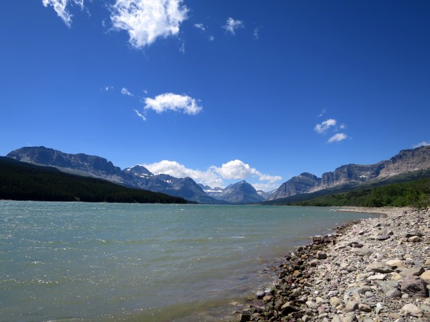
Ever since I first visited 3 years ago with my friend Carrie, Glacier has remained one of my absolute favorite national parks. Big mountains, glacial lakes, towering fir trees, tremendous waterfalls, and (of course) glaciers are an irresistible combination to me. Our first day there we drove Going to the Sun Road to St. Mary’s and then went over to Many Glaciers just to get an overview and walk around Sherburne Lake. We walked a in a few places, but mostly we practiced our touristing. Oh, and we saw a grizzly munching from the side of the road.


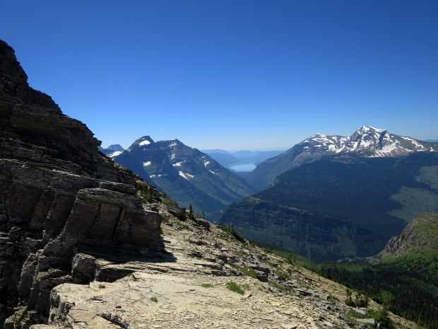
Our second day however we left early in order to drive up to Logan Pass to hike the Highline Trail, something I’d been looking forward to for some time. To sum it up, the Highline Trail is one of the best trails I’ve ever hiked. Tom and I both agreed it was equal to the Alice Lake hike in the Sawtooths that we had done a few weeks prior and is, without a doubt, in our Top Ten Favorites.
The trail follows the Continental Divide above the treeline but below the towering, jagged ridgeline, providing spectacular views over the valleys, peaks, and McDonald Lake to the west. In addition to the amazing views throughout the entire trail we encountered a pair of mountain goats grazing within a quarter mile of the trailhead and approximately a half dozen marmots who were entirely habituated to humans.
We began the hike thinking we would turn around at some point to be determined, but talking to a few fellow hikers en route we discovered that we could hike 12 miles one way and take the shuttle back to Logan Pass instead so we decided to do that and we were so glad we did because about 7 miles into the trail we came to a 1 mile spur that led to an overlook of Grinnell Glacier and the chain of glacial lakes to the north. It was stunning and my photos so it no justice. After descending the ~900 feet back to the Highline we continued for another mile through open meadow and conifer before descending into the thickly forested and burned areas down to The Loop Trailhead.


Undoubtedly one of the most beautiful places I have ever been. It was a bucket list visit for me about 10 years ago and I was absolutely astounded by it all. I simply have to get back – and show Lina!- this incredible place. Thanks so much for sharing your gorgeous photos, Meghan, and for reminding me of my first trip there! 🙂 xoxo
Yes! Glacier is a real gem and just as lovely the second time. I’m glad you enjoyed reliving your trip! xoxo
Absolutely stunning. I can’t wait to do this hike.
It’s definitely a must-do!