South Dakota High Point: Hiking Black Elk Peak
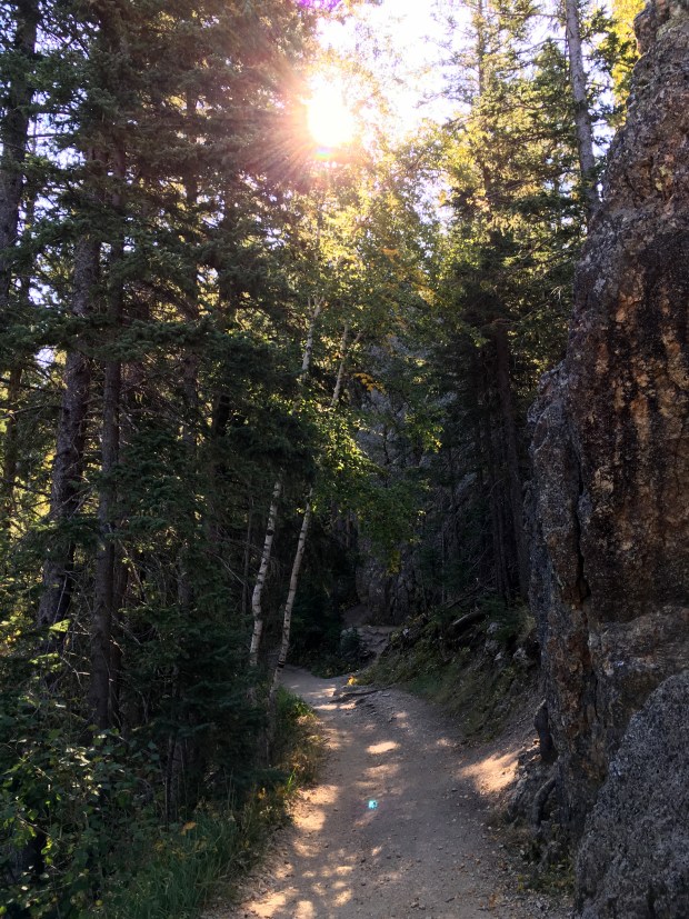
Our last day in South Dakota was spent hiking Black Elk Peak, the highest point of South Dakota at 7,244 ft. The hike was beautiful, but also way more popular than I’d anticipated; the trailhead at Sylvan Lake already had close to 30 cars when we arrived. The first mile-plus was gradual and though I knew we still had some substantial elevation gain ahead of us, I began to understand why so many people were hiking this trail. The easy conditions didn’t last however and soon after entering the Black Elk Wilderness the trail got steep. And then more steep as it climbed up the rocky spires surrounding the high point. But all along the way we encountered families and unseasoned hikers who seemed happy to be going along at their own pace, all of us together enjoying the tall trees and glimpses of the rocky outcroppings as we chugged along.
A half mile below the peak we started up the steep switchbacks and then transitioned to crossing paths carved in the rock and then metal stairs bolted into the mountain. This was clearly the point in which we gained the most significant elevation. But as we turned up another switchback, we found the trail leveling while we had our first glimpse of the beautiful stonework of the CCC tower perched atop the granite. Constructed between 1935 and 1938, the fire tower originally had electricity and heat as well as access to running water thanks to a reservoir constructed below. The day of our visit some carpenters were replacing exterior doors and we shared a laugh about rough openings before Abby and I climbed the tower to the top.
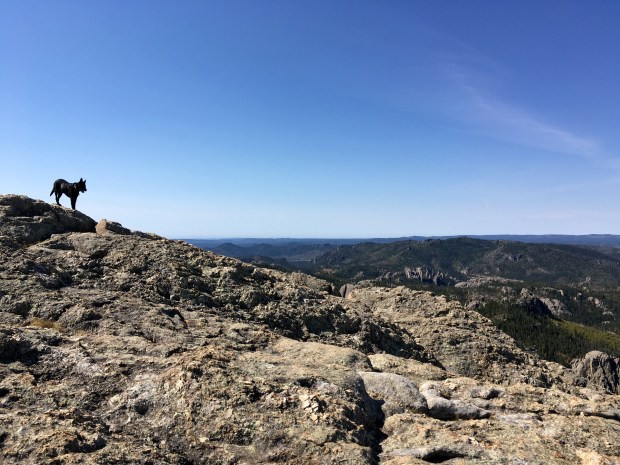
In search of more views we wandered across the expanse of rock spread out below the highest point for awhile, getting a close up of the reservoir as we walked out to the edges of the granite. I took way too many photos in the process, but also just sat and enjoyed a snack with Abby in a quiet spot to the south. This was another place I felt I could have stayed for hours but the descent beckoned eventually and we made our way back down. Our return probably would have been uneventful if we hadn’t decided to take an “alternate route” back to the trailhead: I put that in quotes because on our trail map the route appeared to intersect with the main trail but we ended up adding on a couple more miles in our attempt to find said junction. It did present us with an opportunity to view some of the lush grassy valleys and picturesque streams below the peak however so I can’t call it a loss.


Pingback: South Dakota High Point: Hiking Black Elk Peak – Best of the Midwest – Hiking, adventure and photography
Pingback: South Dakota High Point: Hiking Black Elk Peak — Another Walk in the Park – Best of the Midwest – Hiking, adventure and photography
Those rocky spires are quite unique looking. I like your 360 degree video from the top. We’ve been away for about 6 weeks, with no going on WP, so way behind in my reading! Looks like you’ve been getting in some great hiking.
They are definitely unique- not quite like hoodoos nor like volcanic chimneys. The Black Hills are quite underrated; there are stunning little gems everywhere.
I too have been away from WP quite often the past few months. I’m hoping to get caught up now that I’m not building for a little bit. I know I’m terrible behind reading your blog, and I’m looking forward to catching up.
This hike is definitely on my to-do list, and it looks beautiful! The Black Hills are so underrated.
I agree- underrated! I find myself already wishing we could get back there.
Wow! Those views are stunning! I want to do that hike!
Put it on your list!! It was definitely a treat.
I did!!