Choose Your Own Path: A Hike to Buck Mountain
Buck Mountain is probably best known in the area as the peak with all the communication towers, a secondary or tertiary high point in a cluster of peaks near the mother of Sierra Blanca. I think we first hiked up this mountain a couple years ago by (sort-of) following the Crest Trail north from the trail that leads toward Lookout Mountain, but this peak can be accessed by no fewer than 3 trailheads and there are multiple variations on these routes besides that. The day Tom and I hiked it in August we began at the trailhead in Apache Basin, beginning our ascent via the Crest Trail.
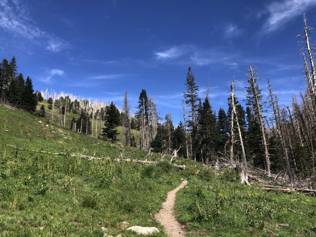
Most of this area was burned in the 2012 Little Bear Fire so much of these first couple miles were spent ducking in and out of clusters of silvered tree skeletons, prickly understory of invasive plants stinging our skin in between the broad stretches of meadow. Beauty was to be seen everywhere however – in the undulating topography of the high grasslands, the expanse of sky overhead, and the remnants of tall firs imagined as forest. As we climbed past 10,000 feet views over the basin revealed themselves and the backbone of the mountains loomed just ahead.


At this point as we crossed onto the south face of Buck Mountain we opted to leave the trail – it having disintegrated into a rocky, thorny mess annihilated by the burn and forbidden an opportunity to regrow under direct sun – instead following the jeep road north and up. This we did until we reached the stretches of untouched meadow clinging to the summits and ridges on the north end of Apache Bowl wherein we wandered off course to better appreciate the nearly-360 degree views. We did of course ascend the 10,769-foot Buck Mountain, populated by soaring manmade columns broadcasting all manners of information, but the highlights of the hike came from these meanderings around the peak wherein we were able to appreciate the swaths of grassy meadows and vistas of treed mountains surrounding us.


Seeing your beautiful photos of Abby in those meadows makes your latest post all the more poignant. Perhaps I should read them in order, but I’m glad I didn’t.
Continue to love reading your blog. E Coast hiker but dig seeing those Rocky Mountain peaks.
I love those expansive views!